Survey QC
The Survey QC feature is being released. These pages describe it as it will appear in WellDesign.
Survey QC checks the raw readings of a magnetic survey, estimates the sensor errors of the survey tool and corrects every station before the well path is built from it. It uses the six raw readings of each station in the Raw survey editor. It runs from the Perform station QC button. Each page in this section says what one part of Survey QC does, what it is used for and how to read its views, with an example chart and a short explanation film.
The order to read the pages
| Page | What it covers |
|---|---|
| Survey QC in One Run | The whole workflow once: the dialog, the run, the indicators, the station rows and the status. |
| From Sensors to a Survey | How six readings give inclination, azimuth, toolface and dip, and the two sensor settings. |
| Geomagnetic & Gravity Models | Where the reference field comes from and how accurate it is. |
| Single-station Checks | Gravity, total field and dip of one station against the reference field. |
| Multi-station Tests | How a whole run shows which sensor has an error. |
| Multi-station Estimation & Correction | The estimated sensor errors, the run grade, the stations set aside and the corrected rows. |
| Sag Correction & BHA Deflection | The inclination error from the BHA bending under its own weight. |
The example
All pages use one example: TALLGRASS 5H, a horizontal well in west Texas with a lateral of about 10,100 ft, surveyed in May 2025 with four MWD runs below a gyro survey. The raw readings are a real survey. The well name is an example name and the position is rounded. Most pages show MWD run 2, which has 99 stations through the curve and most of the lateral. The reference field comes from BGGM2025 and EGM2008, and the sag correction uses an example BHA. Depths are in feet. Gravity residuals are in m/s², magnetic field in nT and angles in degrees, as WellDesign shows them.
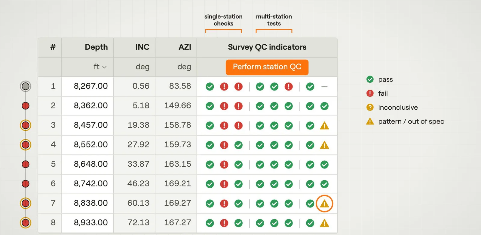 Survey QC in One RunChecks a run of raw readings, estimates the sensor errors and corrects every station.Film · 3:10
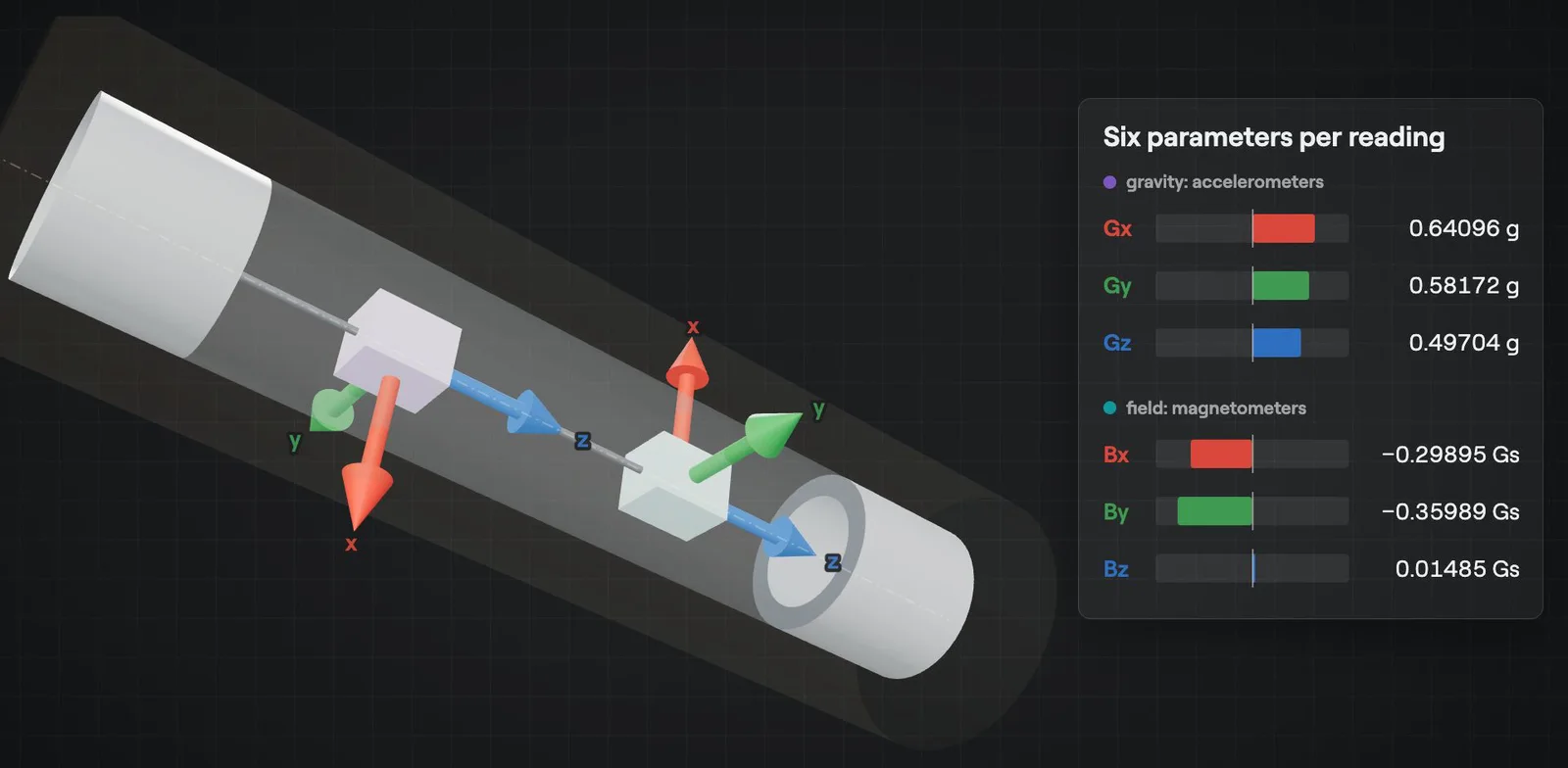 From Sensors to a SurveyHow six raw readings give the inclination, azimuth, toolface and dip of a station.Film · 3:20
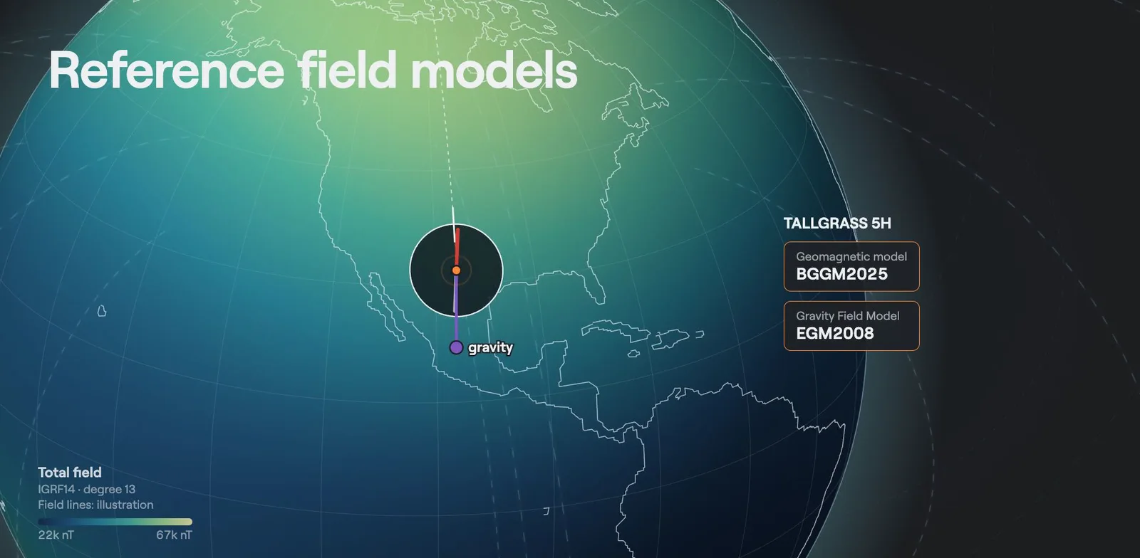 Geomagnetic & Gravity ModelsThe models behind each station reference: declination, dip, total field and gravity.Film · 5:25
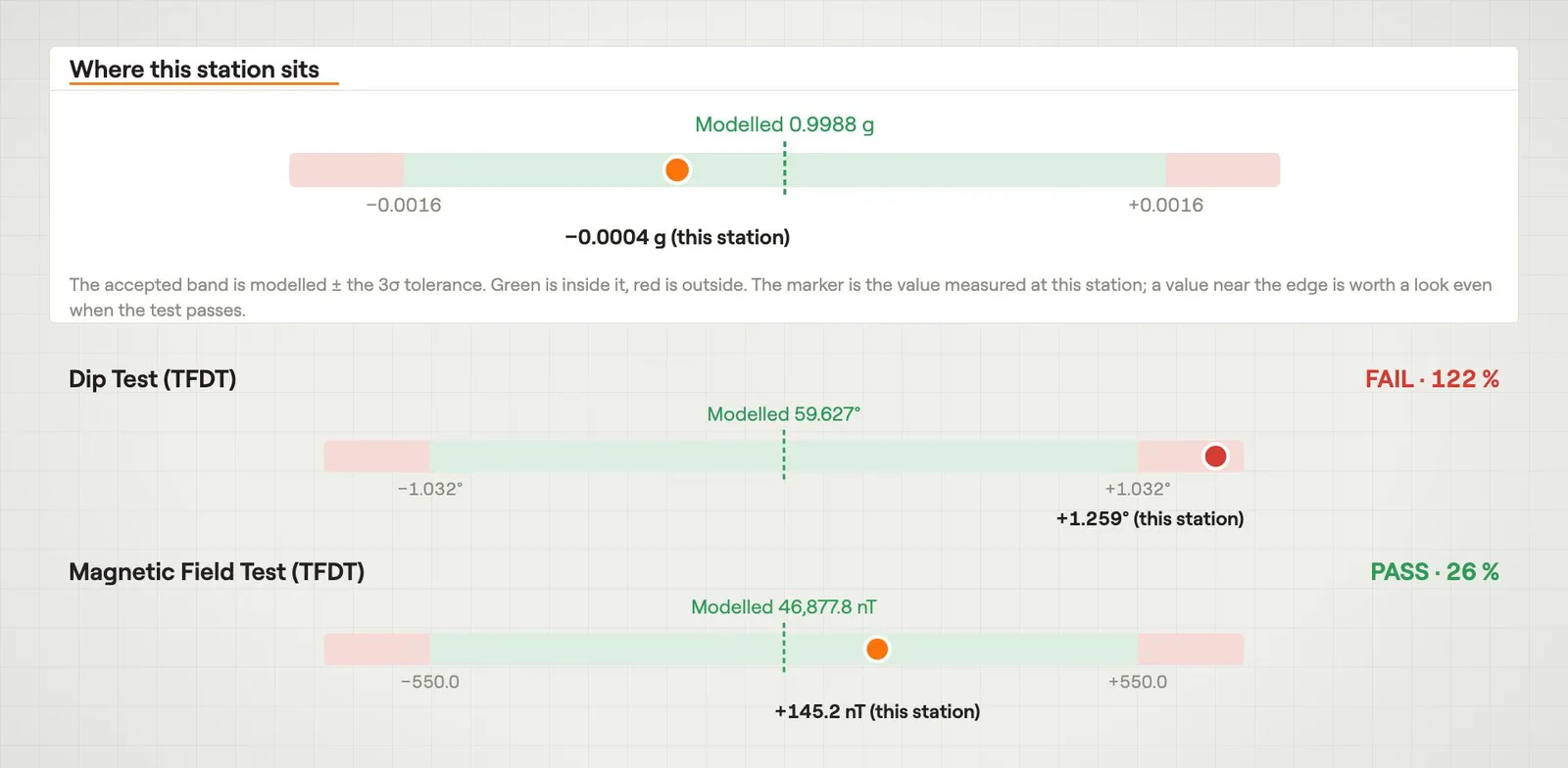 Single-station ChecksGravity, total field and dip of one station against the reference field.Film · 3:08
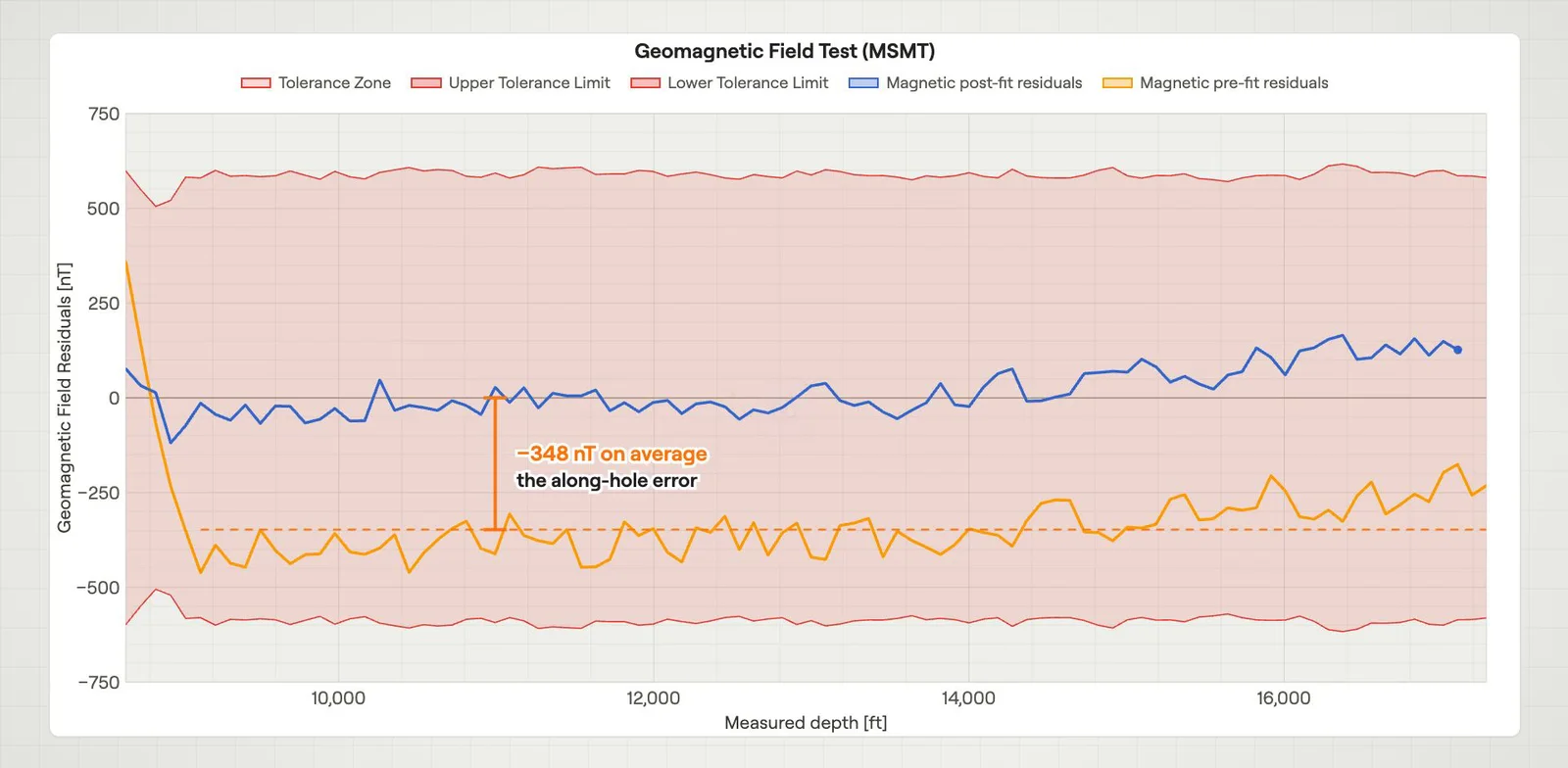 Multi-station TestsFits the sensor errors to a whole run and tests them against the tool model.Film · 3:13
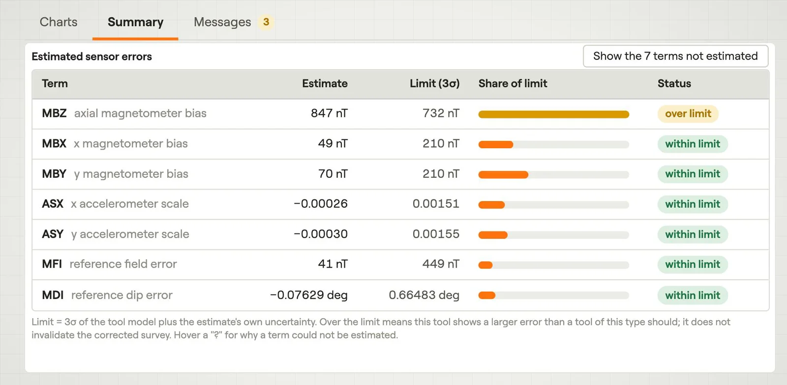 Multi-station Estimation & CorrectionEstimates the sensor errors from a whole run and removes them from every station.Film · 3:34
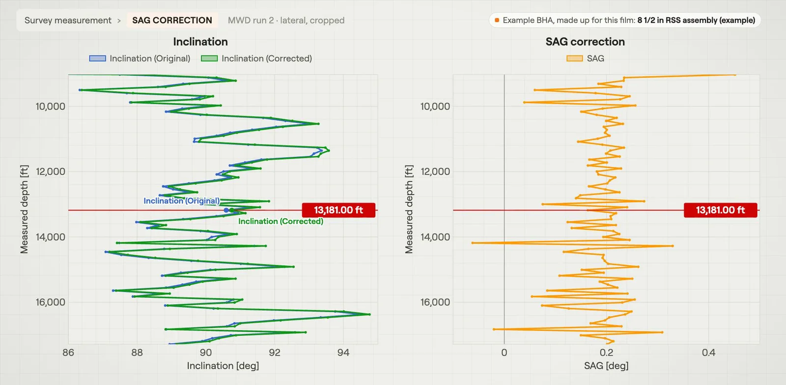 Sag Correction & BHA DeflectionAdds back the inclination error from the BHA bending under its own weight at the sensor.Film · 3:21